July 20, Day 18 of TheHopeLine Tour of 2014
What a difference a day makes…especially a rest day. Sunday morning found us at The Church of the Nazarene in Grangeville, Idaho. We felt most welcome and at home. We shared TheHopeLine with the pastor as well as one of the adult Sunday school classes. Two of the members presented us with checks, which we encouraged them to simply mail in to TheHopeLine. They immediately understood the value of what TheHopeLine is all about and felt compelled to give. What an encouragement!
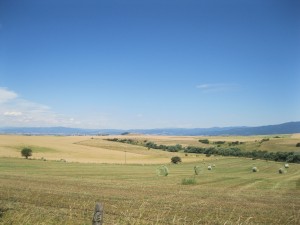
 We like Grangeville, Idaho. The people are very friendly and the town is small and isolated enough to allow access to all services within walking distance. The motel proprietor granted us a grace period for checkout. So, after church, we returned to the motel and checked out. Soon, we were cycling through beautiful wheat fields on a large plateau. Even the temperature had moderated on this day. We spotted our first deer sighting of a day that would be filled with them.
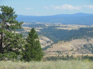
 Fifteen miles later, we plummeted into the river valley. We dropped 1,500 feet in a flash, and found ourselves in a completely different world. The view at the top of this drop defies explanation, but I’ll give it a shot anyway. Not even our cameras could really do it justice. With the luscious golden wheat fields behind us and to our sides, mountains splashed with evergreen trees and remnants of desert were visible 180 degrees in front of us. The backdrop on this canvas were distant mountains. Those hills were a darker hue of bluish gray, which provided a rich contrast to the evergreen forests in front of them. It was a multi-dimensional scene, a parabolic painting that we couldn’t fully absorb without swiveling and nodding our heads about as far as they would go.
A local stopped his pickup as I was taking photos topside to warn me about the switchbacks at the bottom. He said there were two 10-mph switchbacks that were dangerous if we didn’t slow our bicycles. It was a valuable warning. We were headed down the chute, but in a good way. The descent was steep, and we applied the brakes constantly to slow our heavy loads. Our descent was more of the elevator type rather than the typical, more gradual escalator. And the road conditions were not that great. Consequently, we rode with extra caution, which served us well as we could enjoy more of the fabulous view on the way down.
At the bottom, we cycled beside a river for several miles when a deer darted out in front of Debbie. Just as quickly, it leapt to the other side of the road and cleverly vanished out of sight, despite thin cover. After a late lunch in Kooskia (pronounced Koo Ski), we headed up Route 12, which we will follow for a few days. Route 12 will take us to Montana through Lolo Pass.
This latter portion of our ride was reminiscent of our “honeymoon on wheels” in 2010. Today’s path essentially merged with the Lewis and Clark Trail when we hit Route 12, the bicycle trail that we followed on our previous cross-country tour. Route 12 runs adjacent to the Clearwater River. Light Sunday evening traffic, comfortable temperatures, and the sound of rushing water from the river made for a pleasant ride into Lowell, where we stayed for the night. A few more deer sightings and no cell service reminded us that we were soon to enter the wilderness, if indeed we had not already done so.
————————————————————————-
If you have not already pledged your support to TheHopeLine, please consider doing so. Your entire contribution will go directly to help young people struggling with life. You can pledge online at this webpage. If you’re wondering why it is a good investment, please read this webpage.

Hey Tim and Deb,
Man, what an absolutely phenomenal picture looking down into that valley. Just takes your breath away. Nice job describing it Tim, Almost poetic in your ramblings there. Another side to you, old friend. Here’s hoping your saddle ailments don’t plague you as much this time around…Good Traveling